Touratech-USA customer service will be limited on June 25-26 and all operations will be closed Fri June 27 for our annual Touratech Rally. Normal operations will resume starting Monday June 30.
Garmin Sale!
We're offering $50 off Zumo XT2 GPS Units and $75 off Zumo XT2 Locking Mount Packages from 6/9 - 7/7/25. Click HERE to see the deals!
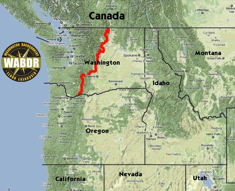
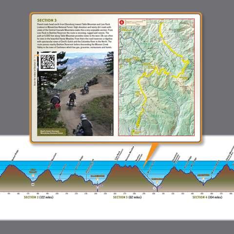
Butler Motorcycle Maps - Washington Backcountry Discovery Route (WABDR)


Butler Motorcycle Maps - Washington Backcountry Discovery Route (WABDR)
Questions about this product? Call 1-800-491-2926 or e-mail our sales team
Details
The Washington Backcountry Discovery Route (WABDR) is a scenic route across Washington State from Oregon to Canada through the Cascade Mountain Range. The 600-mile route follows a connection of mostly unpaved back roads that can be ridden on dual-sport and adventure motorcycles or driven in 4x4 and high-clearance 4WD vehicles. The route is usually snow-free July through September.
This map is a planning tool to help you prepare to ride the Washington Backcountry Discovery Route. Make sure to bring detailed forest maps and a GPS unit with the route tracks to navigate the route. This planning map does not have the detail required to be a primary navigation tool.
Please visit the WABDR Website for more information on the route and to download the free GPS tracks, then watch the Expedition DVD to get inspired for your ride.
Related Products
")

")
")
Safe Shopping. Guaranteed.
Your safe shopping experience is protected by EV SSL certificate technology with 256-bit RSA encryption.
EZ RETURNS. No Restocking Fees. No Problem.
We want you to be HAPPY. If your order is not everything you dreamed, we'll fix it. Whether it's the wrong size or just not what you wanted, you can return it for a refund. We'll never charge a restocking fee for items returned in new unaltered condition within 60 days. Just return the item and we'll issue a full refund to the original payment method.


